Impact
Our Approach
Footways is a tool for change as much as a walking network. We want to:
get people walking both more and further on everyday journeys
identify and bring about infrastructure improvements
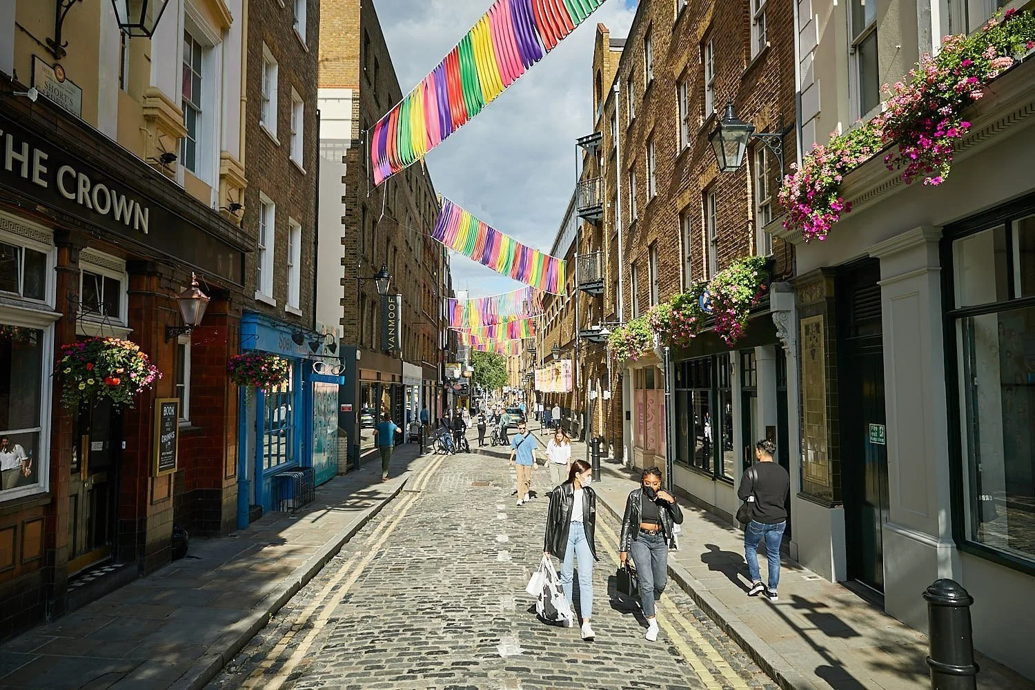
boost footfall and life of high streets
help people access local services, destinations and transport hubs on foot
embed walking routes into transport and regeneration plans
connect low traffic neighbourhoods to create wide networks for walking
-
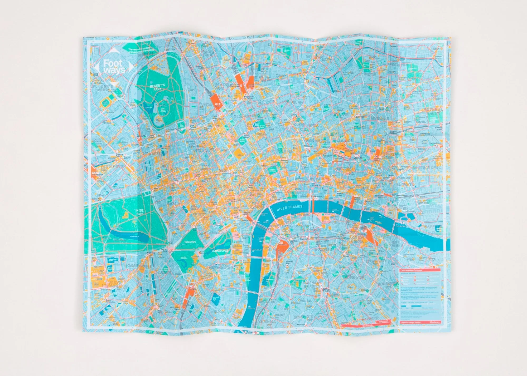
We have distributed more than 50k copies of our printed maps for Central London, Hackney and Camden Town.
We have developed dozens of bespoke digital maps for museums, galleries, business improvement districts, local and regional government showing walking routes and features.
-
Sponsors and partners include Transport for London, Greater London Authority, Network Rail, LNER, City of London Corporation, Islington Council, Hackney Council, Westminster City Council, Camden Council, Camden Town Unlimited, King’s Cross/Argent, Northbank BID, Cross River Partnership, Central District Alliance and Urban Partners.
-
Our digital maps — available both on Mapbox and Google My Maps — have been viewed more than 2 million times.
Our map on Science Museum’s Visit page is viewed more than 40k times a month.
Footways features on TfL’s Walking page.
-
Our project has received media coverage in The Sunday Times, BBC Radio London, The Telegraph, Time Out, The Metro, Lonely Planet Travel News, My London, Runners World, Monocle and local press.
-
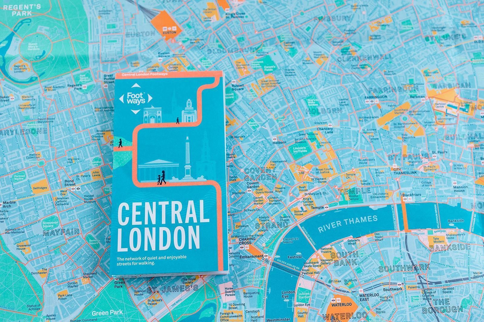
Central London Footways was ‘Map of the Month’ at Stanfords and its top-selling map in November 2022.
Footways won a Network Rail Achieving Communications Excellence (ACE) award in 2022.
-
We have helped develop leisure walking routes and trails including a new route from Peckham to Epping Forest for Transport for London’s Walk London Network; Nature Trails for the Greater London Authority; I-Spy walks with Islington Clean Air Parents; and a Jewish Heritage Trail for Chabad Islington.
Our Impact
Campaigning
-
Through housing estates — the reconfiguration at Dovercourt, Islington is a model for future developments.
To mainline stations — we have proposed to Westminster Council the creation of a new public space on London Street opposite Paddington Station.
Connecting key destinations — we highlight the importance of linking new public spaces with good walking routes.
New walking routes — we have proposed to Camden Council a new green link between Euston and Regent’s Park.
Green corridors - Footways supports improvements including rain gardens and greenery along urban streets and estates. Islington Council included our suggestion for a green corridor its proposals for a Cally Liveable Neighbourhood.
-
We support local authority officers and councillors in developing low traffic routes, including Red Lion Street and Monmouth Street in Camden.
We champion innovative work such as low traffic neighbourhoods and link them into our network.
We were a member of the Sustainability Working Group for the Strand Aldwych programme.
-
Councils rarely mentioned walking routes before our work began. Now they are regularly referred to in transport strategies and other documents. Footways is referred to in Camden's Transport Strategy and Guy’s and St Thomas’ Transport Strategy 2023-27.
-
We have delivered conferences with organisations including Living Streets, the Urban Design Group and the Active Travel Academy at University of Westminster.
Footways has spoken at London's Walking & Cycling Conference, Better Streets Summits, Living Streets events and more.

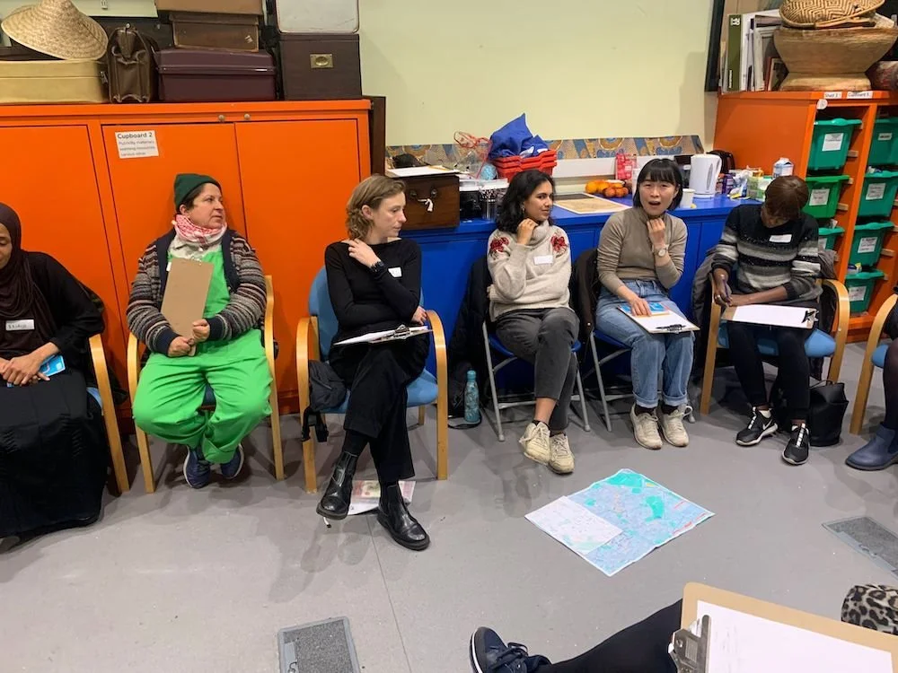
Community engagement
Footways is all about engagement. We use our maps and their development to talk to people, businesses and organisations about routes and local points of interest that make walking enjoyable and interesting.
This ensures that the networks reflect the needs and interests of local communities and visitors.
It’s also a good way to understand how public spaces can be improved.
Partnerships
Past Projects
-
Transport for London sponsored the first edition of Central London Footways in 2020 and promotes our network from its Walking page.
"We're proud to join London Living Streets in introducing the new Footways map, which is a beautifully illustrated guide to all that London has to offer. These quiet and accessible routes highlight just how easy and surprisingly quick it is to explore our city on foot.” - Christina Calderato, Head of Transport Strategy and Planning at TfL.
-
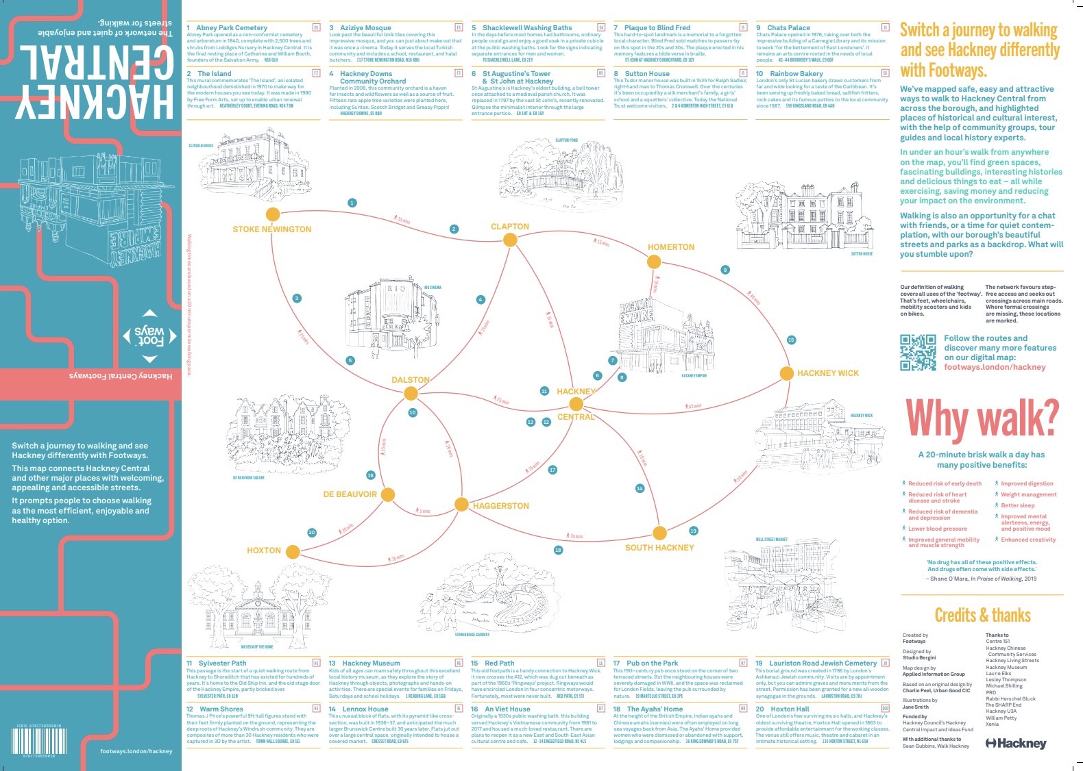
We worked with Hackney Council and conducted extensive engagement with local communities to produce a new walking map for Hackney, designed to help people explore the borough and get around in a healthy, sustainable, and enjoyable way.
This created the Hackney Central Footways 2023 with an A2 paper and printed map.
-
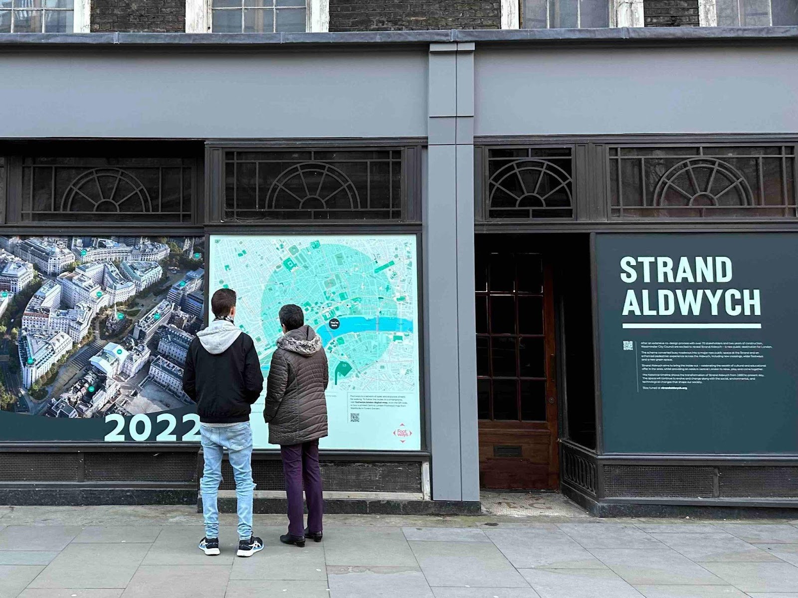
Westminster Council created a billboard map of our routes to encourage people to walk to/from the Strand Aldwych new public realm scheme when it opened to people in late 2022.
-
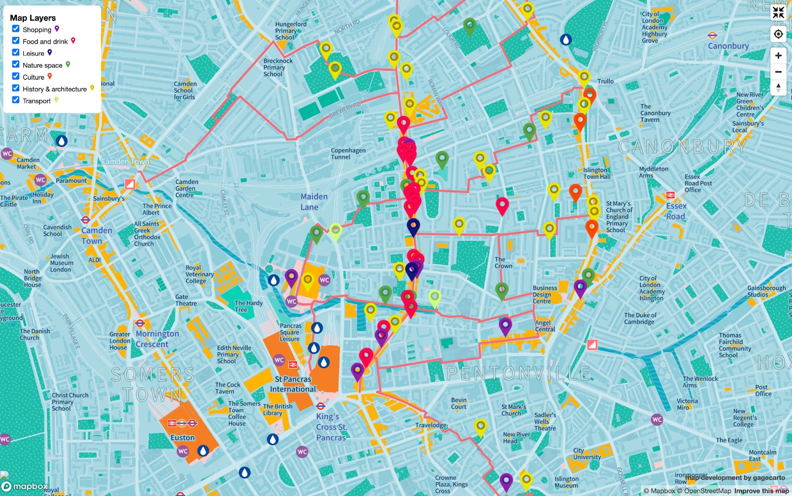
We worked with Islington Council to produce digital walking maps that highlight a network of walking routes from housing estates and along quiet routes around the Caledonian Road area.
-
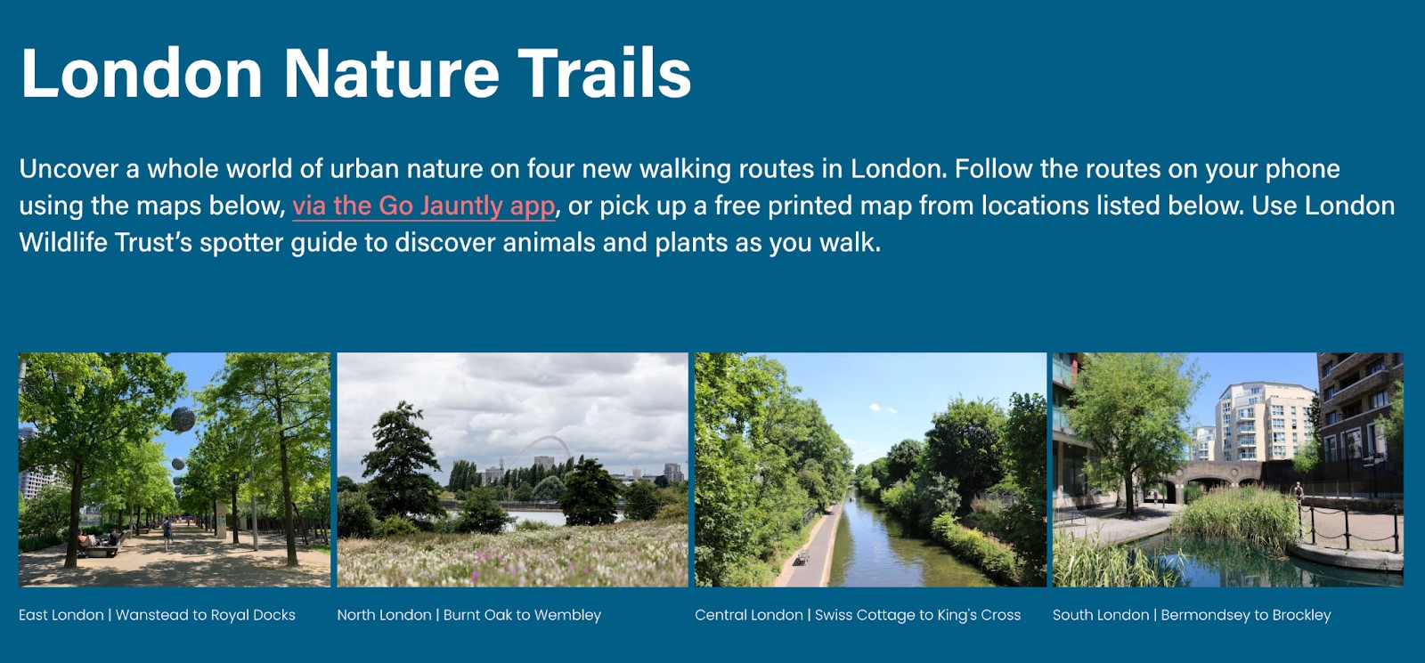
With the Greater London Authority we published four printed and digital maps focusing on new nature walking trails published August 2022 for Deputy mayor for environment in August 2022.
-
Our second and third editions of Central London Footways were sponsored by Network Rail, winning a Network Rail Achieving Communications Excellence (ACE) award.
"Footways has been a tremendous success at King’s Cross Station," - Aun Abidi, Kings Cross Station Manager.
-
We have developed a digital and printed map with Business Improvement District Camden Town Unlimited and Euston Town to connect the green and cultural spaces in the King’s Cross, Euston and Camden Town area for people on foot.
-
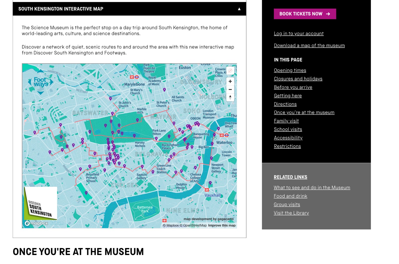
We developed an interactive walking map to the museums and destinations on Exhibition Road, this included a social media launch for the map and led to the Science Museum publishing the map on its ‘Visit’ page.
Ongoing projects
-
We are developing a large poster for display in the hospital's entrance hall with walking routes to the hospital for both staff and patients.
-
We are developing a digital map for Westminster Council to launch in January 2024 and potentially a paper map to launch in late spring 2024.
-
We devised the routes for a Jewish Heritage Trail in Islington and are working with Chabad Islington to create a paper and digital map.

Footways Supporters & Partners


We are always open to exploring opportunities of working with existing partners and organisations we have not worked with previously to improve walking environments in cities and getting people walking more and further.
Whether you want to develop print, digital or billboard walking networks and maps, deliver community engagement activities around walking networks, or require expert support and advice on how to improve walking environment and networks; you can get in touch by either emailing hello@footways.london or use the form below
Partner with us
We will get back to you as soon as we can.
Footways.london is gathering your data so we can answer your question or respond to your feedback. We won’t share your details with any third parties and you can unsubscribe at any time. The email address is monitored by Emma.
Footways, 280 Mare Street, London, E8 1HE