Work with us
Why partner with Footways?
Walking is the most common form of transport — part of almost every local journey — yet it is routinely under-planned and under-funded. We exist to change that.
We work with transport authorities, councils, Business Improvement Districts and communities on two things: planning walking networks properly, and making maps that bring those networks to life.
Walking network consultancy
Most towns and cities don't have a walking network plan — no route hierarchy, no clear picture of where the gaps are, no coherent basis for investment. We help fix that.
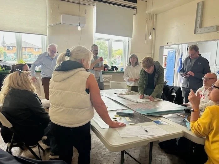
Our methodology combines data analysis, on-street fieldwork and community engagement. The result is a clear picture of how people actually move (and why they don't): which routes to prioritise, where the barriers are, and what improvements would unlock more everyday walking. We also help package that evidence into fundable, coherent schemes.
Our clients include transport authorities, local councils and national bodies. We recently led a national walking network pilot for Active Travel England across five English towns and cities, working alongside Living Streets to develop route hierarchies, identify infrastructure barriers, and produce evidence packs for each council.
We can help you:
Develop a walking network plan and route hierarchy
Identify suppressed demand, particularly in deprived communities
Reveal accessibility barriers and prioritise fixes
Build the evidence base for developer contributions, funding bids and Local Cycling and Walking Infrastructure Plans (LCWIPs)
Think strategically about walking, rather than reactively
Design-led maps
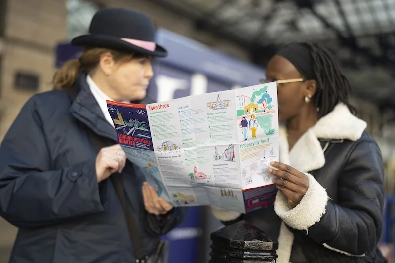
We produce beautiful printed and digital walking maps — objects people want to keep and use.
Unlike mainstream journey-planning apps, we prioritise enjoyment and environment alongside directness. Our routes seek out quiet streets, green spaces and local character. These maps change how people think about everyday journeys — and they work as powerful tools for councils and BIDs to promote walking and place.
Our printed maps have achieved top sales status at Stanfords, London's world-famous map and travel bookstore. Nearly 37,000 copies have been distributed through Network Rail's London stations alone. The Westminster Footways map has been reprinted by Westminster City Council — a sign of public demand and partner confidence.
We have produced printed and digital maps for:
London boroughs including Westminster, Hackney and Islington
Business Improvement Districts across central and inner London
Network Rail and London's mainline stations
Cultural institutions and visitor destinations
Accessible by design
Footways routes are step-free where possible, and our quieter routes appeal to people with sensory sensitivity. We identify accessibility barriers to help councils prioritise fixes — and we are exploring how our routes can power navigation tools for blind and visually impaired users
Our impact
40,000 Central London Footways maps distributed at Network Rail's London stations
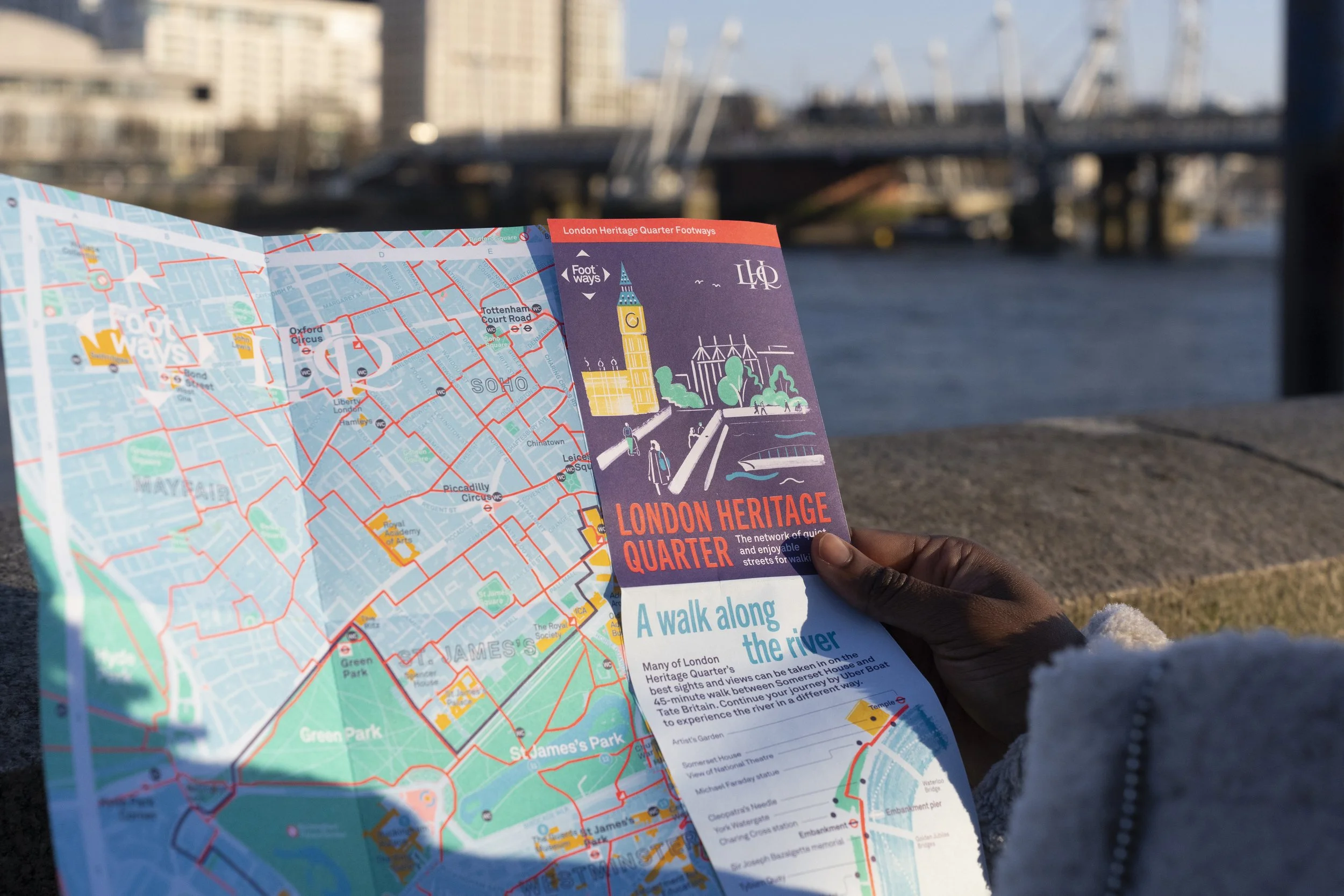
20,000 London Heritage Quarter Footways maps distributed by LHQ ambassadors and stations
20,000 Westminster Footways maps distributed by Westminster City Council at libraries, leisure centres and housing centres
10,000 Smithfield & Clerkenwell maps distributed by local museums and community organisations
~20,000 digital map views each month
Maps reprinted by partners — a sign of lasting demand
Footways maps appear on websites of museums, Business Improvement Districts, councils, and Transport for London’s Walking page
Transport strategies, including TfL, Hackney & Camden Council, cite Footways as tool to boost walking and improve infrastructure
Top-selling map at Stanfords
Winner, Network Rail Achieving Communications Excellence award
Commended in the British Cartographic Society awards
What our partners say
"We're proud to join London Living Streets in introducing the new Footways map, which is a beautifully illustrated guide to all that London has to offer. These quiet and accessible routes highlight just how easy and surprisingly quick it is to explore our city on foot." — Christina Calderato, Head of Transport Strategy and Planning, Transport for London
"Footways has been a tremendous success at King's Cross Station." — Aun Abidi, King's Cross Station Manager, Network Rail
“The LHQ Footways map has been a big hit. It helps with engagement and allows the public to plan out their day.”— Mata, London Heritage Quarter Ambassador
"The Footways map of Westminster shows the council investing in infrastructure to make walking safe and pleasant — and the inspiration to get more people walking." — Cllr Max Sullivan, Cabinet Member for Streets (2025-26), Westminster City Council
"People often arrive at our museum by wandering, and when they leave they're asking where to explore next. The Footways maps are perfect — they highlight the area's history and the best routes. And as soon as one person picks one up, everyone else wants one too." Melanie Nightingale, visitor engagement assistant at the Museum of the Order of Saint John.
Get in touch
If you'd like to talk about working together — whether on a walking network plan, a map, or something in between — we'd love to hear from you. : hello@footways.london

Case studies


Our partners
-
Transport for London sponsored the first edition of Central London Footways in 2020 and promotes our network from its Walking page.
"We're proud to join London Living Streets in introducing the new Footways map, which is a beautifully illustrated guide to all that London has to offer. These quiet and accessible routes highlight just how easy and surprisingly quick it is to explore our city on foot.” - Christina Calderato, Head of Transport Strategy and Planning at TfL.
-
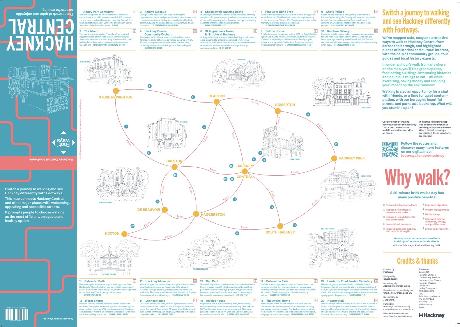
We worked with Hackney Council and conducted extensive engagement with local communities to produce a new walking map for Hackney, designed to help people explore the borough and get around in a healthy, sustainable, and enjoyable way.
This created the Hackney Central Footways 2023 with an A2 paper and printed map.
-
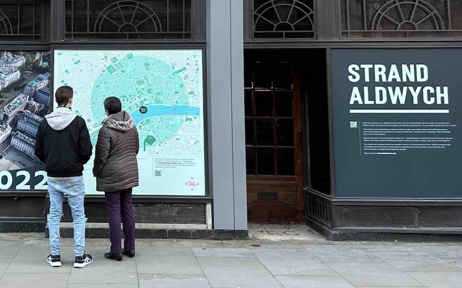
Westminster Council commissioned us to create a digital and printed map of walking routes across the city. The printed map was published in July 2025. A billboard map of our routes was also posted on Strand Aldwych when the new public realm scheme opened in 2022.
-
We worked with Islington Council to create digital and paper maps of Clerkenwell, encouraging residents and visitors to explore this history-rich neighbourhood on foot.
Together with Islington we also produced digital maps that highlight a network of walking routes from housing estates and along quiet routes around the Caledonian Road area.
-
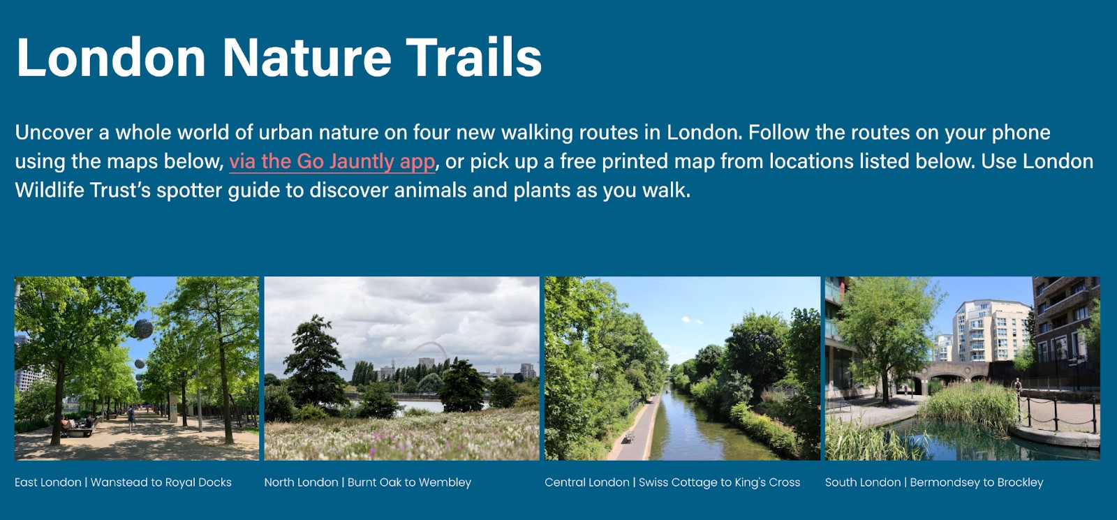
With the Greater London Authority we published four printed and digital maps focusing on new nature walking trails in August 2022.
-
Our second and third editions of Central London Footways were sponsored by Network Rail, winning a Network Rail Achieving Communications Excellence (ACE) award.
"Footways has been a tremendous success at King’s Cross Station," - Aun Abidi, Kings Cross Station Manager.
-
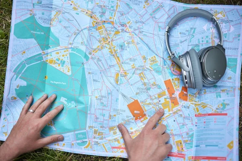
We have developed a digital and printed map with Business Improvement District Camden Town Unlimited and Euston Town to connect the green and cultural spaces in the King’s Cross, Euston and Camden Town area for people on foot.
-
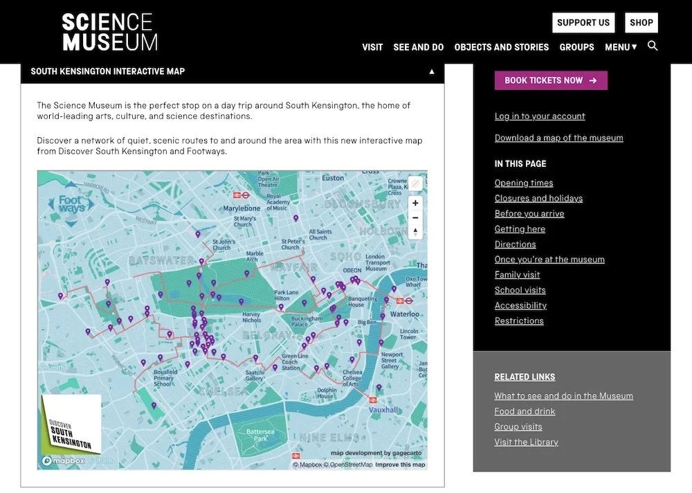
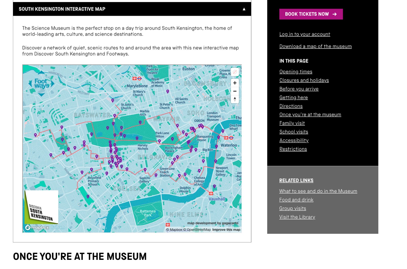
We developed an interactive walking map to the museums and destinations on Exhibition Road, this included a social media launch for the map and led to the Science Museum publishing the map on its ‘Visit’ page.


